Introducing the Collision Database Management System
Gone are the days of using legacy or complicated desktop traffic collision database software. The Collision Database Management System provides all the tools needed in an easy-to-use, powerful web interface. It focuses on the features you need and leaves out the rest.
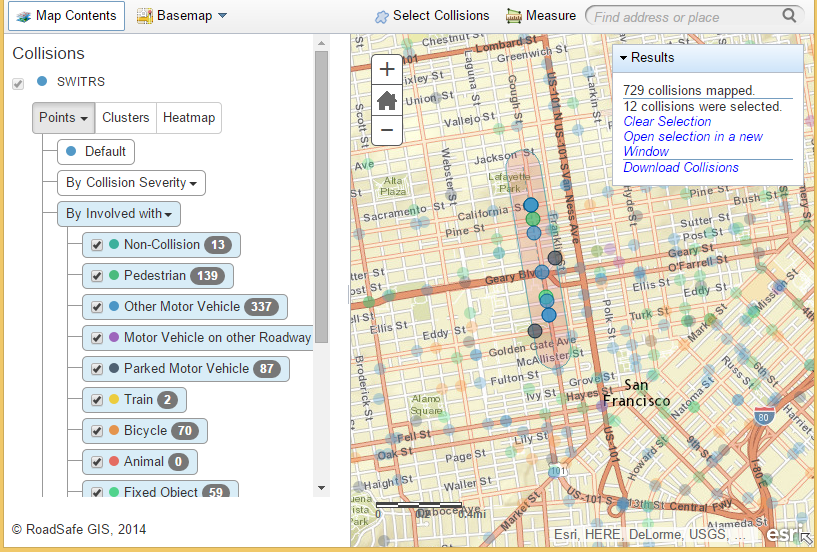
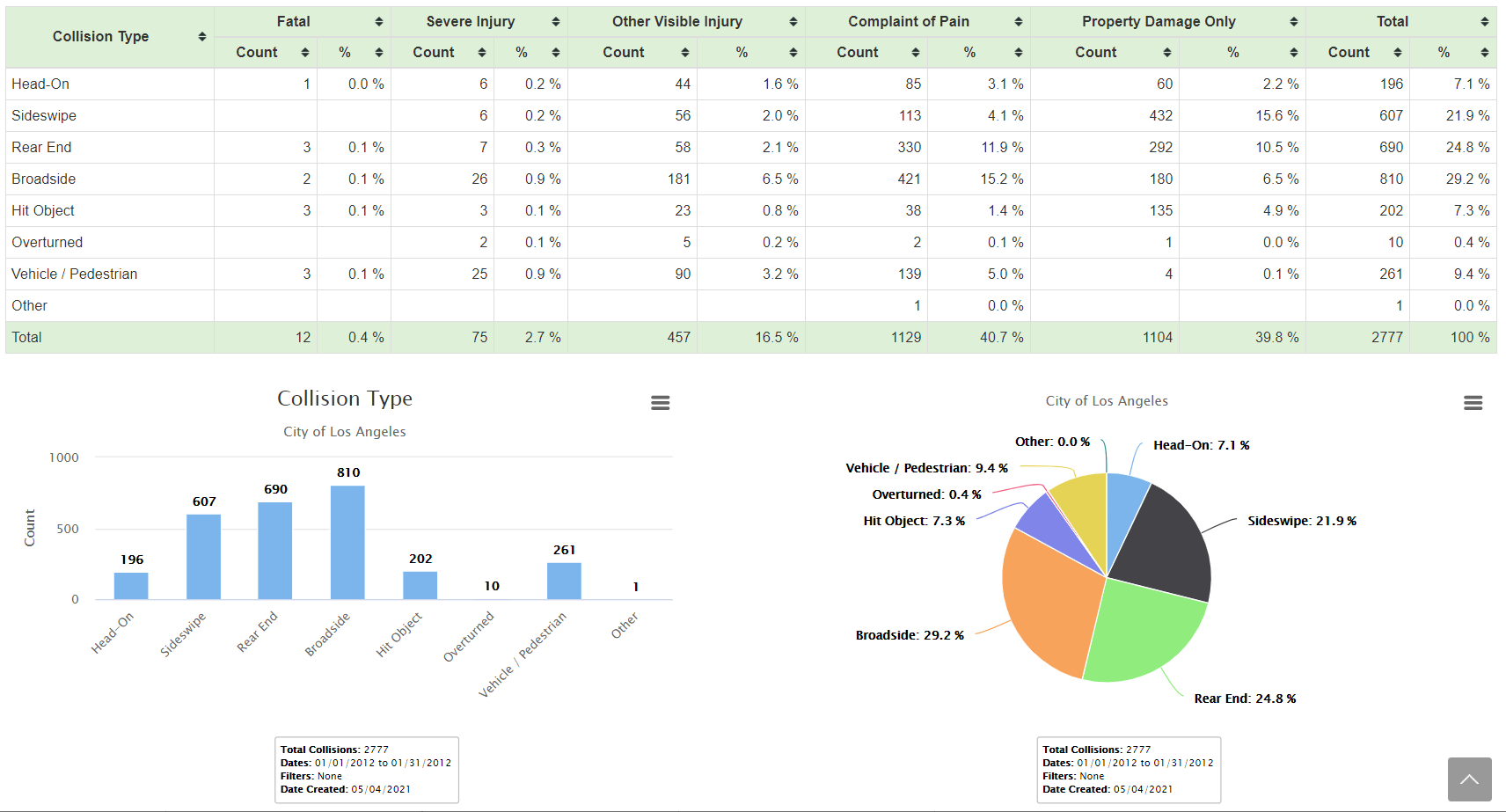
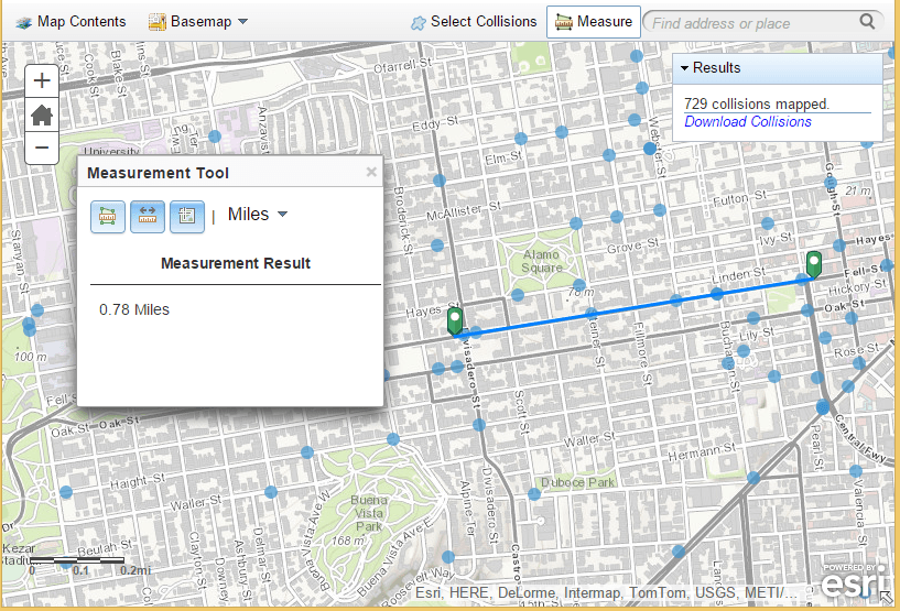
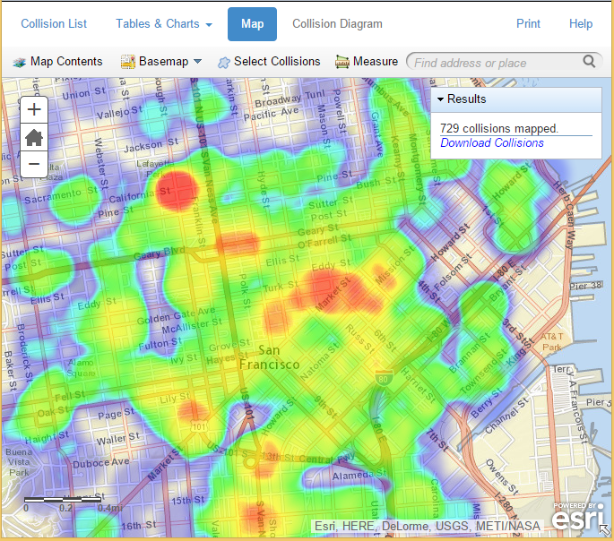
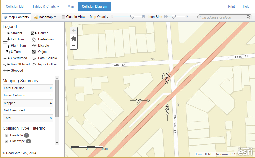
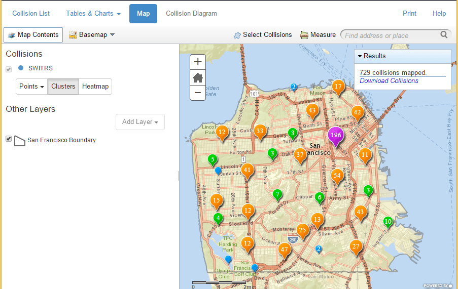
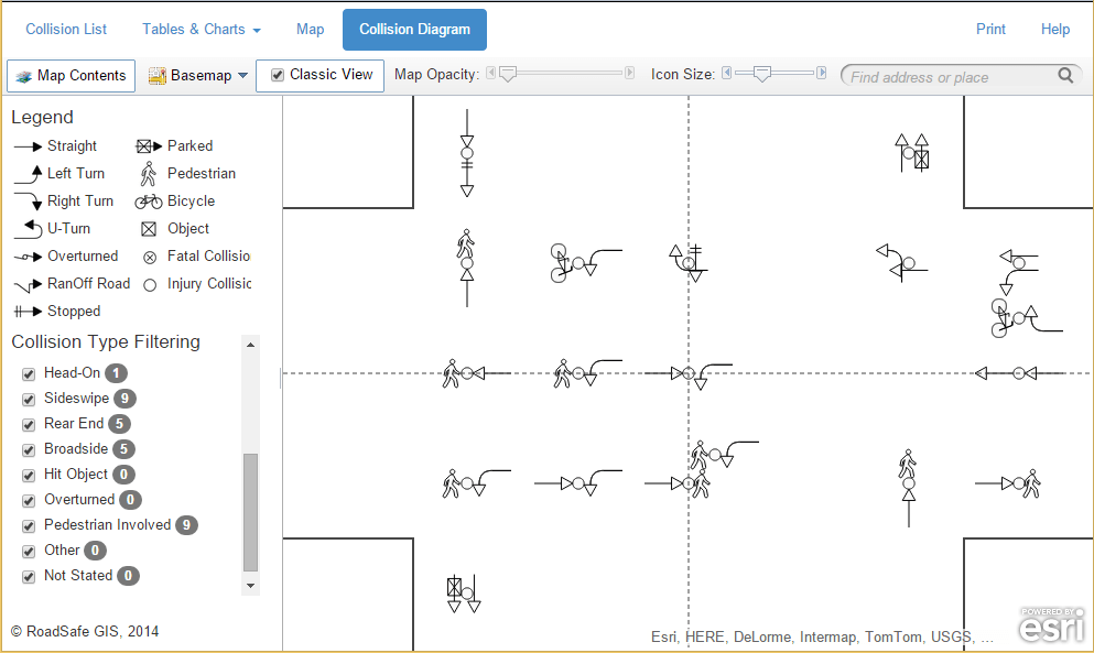
Collision data analytic capabilities to satisy all levels of users.
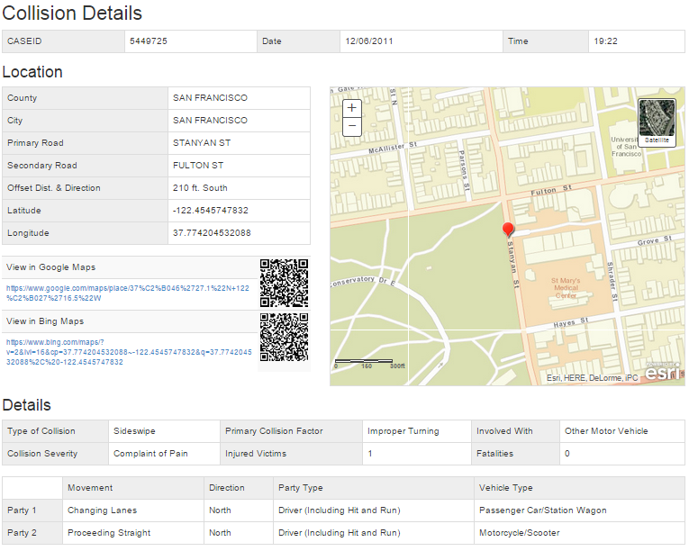

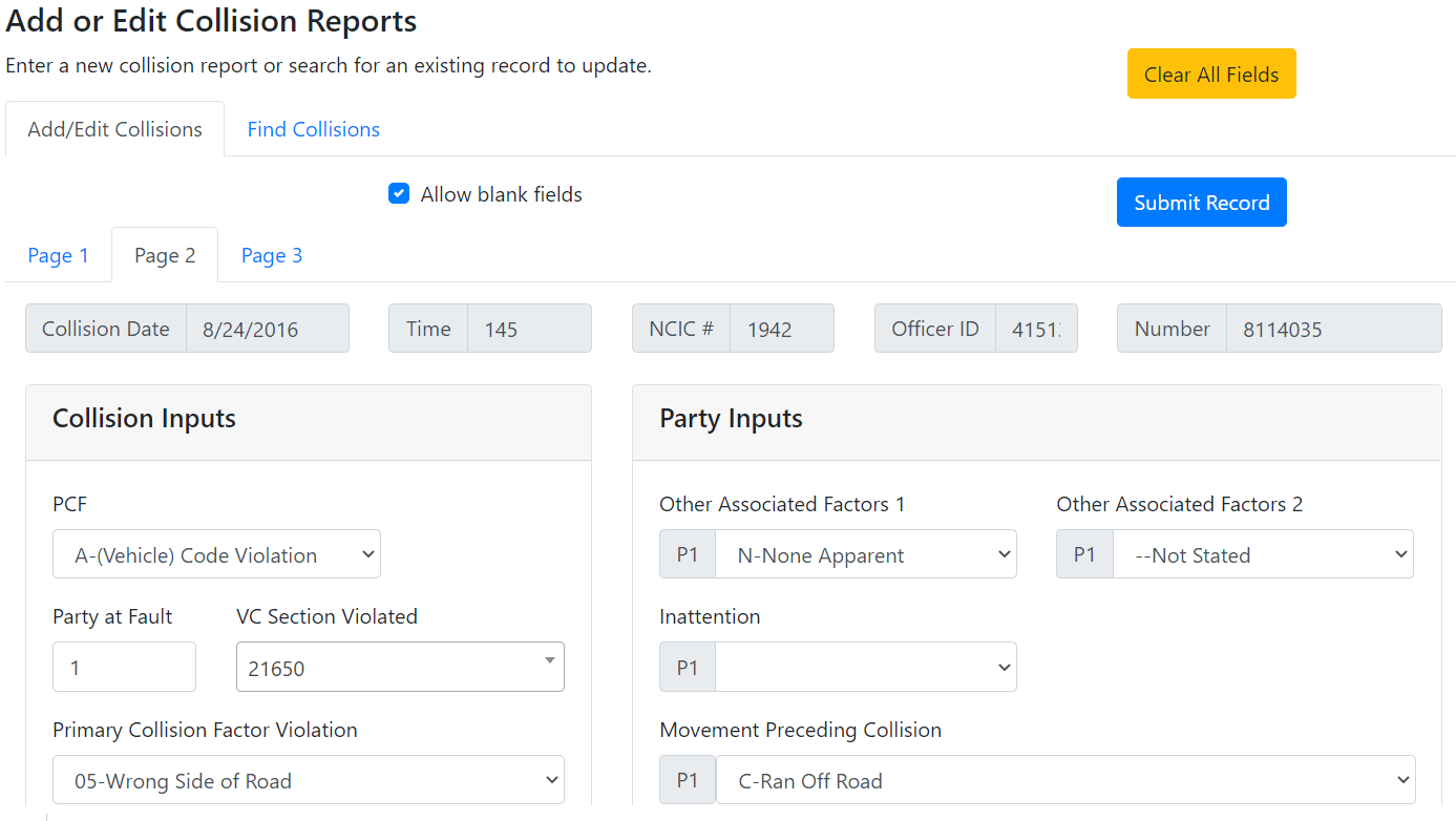
Need full control and access to edit individual collision records? A complete interface for data input and editing needs is available. Includes the ability to restrict access to only specified personnel to ensure data consistency

When you subscribe to the Collision Database Management System, our team of experts is at your service. We handle web application and database management so you can focus on your analyses. Optional data retrieval and geocoding services are also available.
- You provide us with a data template and initial dataset
- We geocode the collisions if necessary, including any intersection offset
- We handle all maintenance and software updates
- Includes options for data retrieval and updates
- Or direct import of data from other software solutions
Your agency can benefit in a variety of ways.
Cloud hosted web interface
- Access from anywhere
- Hosting, maintenance and automatic updates included
- No extra work for your IT department
Data interoperability
- Geocoded collision data can be exported to .csv or Google KML file
- Import into ArcGIS Desktop or Online, QGIS, Google Earth or others
- No data lockdown inside our Collision Database Management System
Data connector capabilities
- Set up direct connect data conversion and import capabilities
- Continue using alternate software, but take advantage of CDMS features
- Alternatively, allow us to import new data from third party source
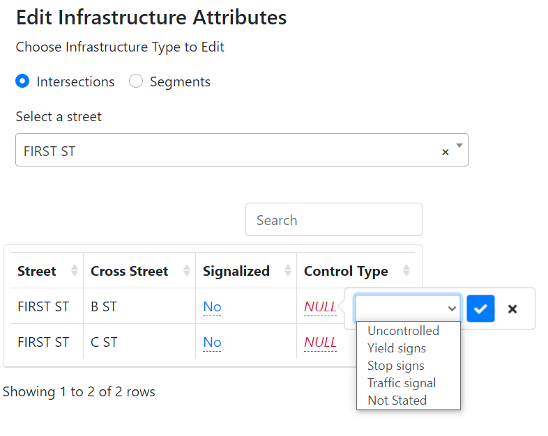
Infrastructure data integration
- Incorporate your intersection traffic volumes to produce crash rates
- Integrate roadway element data as query filters
- Query intersection collisions by signal type, crosswalk presence, etc.
The Collision Database Management System can fulfill the needs of many different users within an organization
Managers
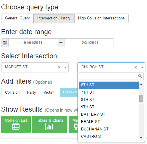
- Quickly search for high level summaries or history of a specific intersection
- Check statistics while on the go
Planners
- Review intersections or corridors for proposed new development projects
- Can access data directly without requesting from traffic engineering
GIS Specialists
- Get quick summaries of collisions before exporting data to advanced desktop GIS software
- Directly access GIS web service or include the web service in other agency web applications
Traffic Engineers
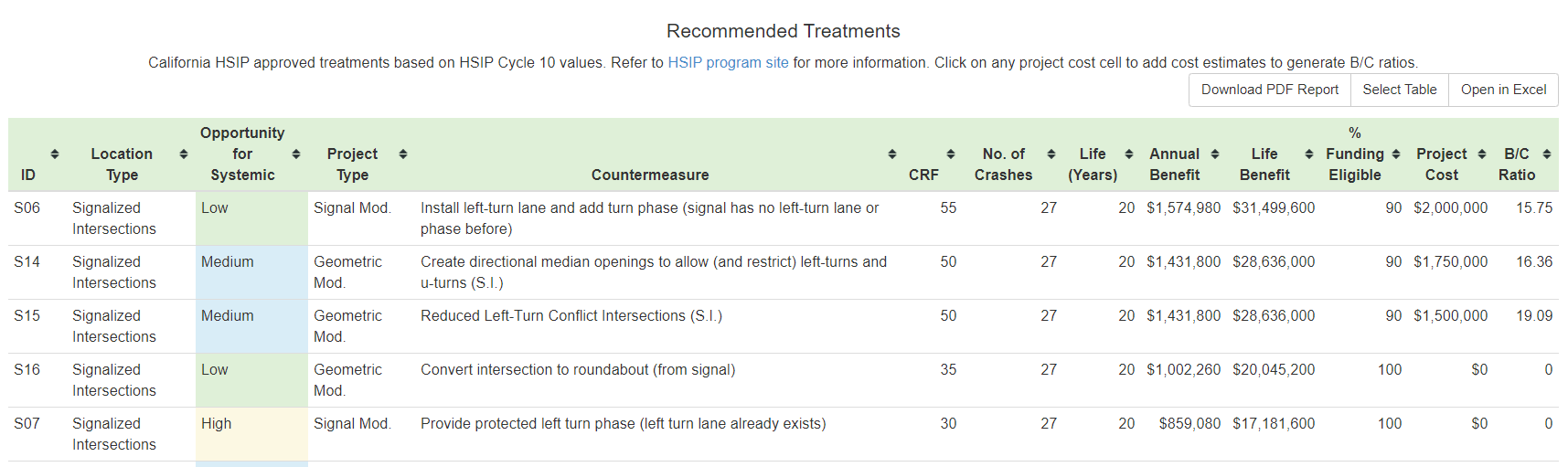
- Research data merits for physical traffic calming measures requests
- Prioritize locations for countermeasure funding application requests
Police Officers
- Review locations of frequent alcohol involved collisions for sobriety checkpoints
- Identify pedestrian or bicyclist safety trouble areas for enforcement